
Maps for Excel
geocoding heatmap boundaries dicrections streetview placeid
| About | Details |
|---|---|
| Name: | Maps for Excel |
| Submited By: | Wiley Lubowitz |
| Release Date | 1 year ago |
| Website | Visit Website |
| Category | Spreadsheets Maps |
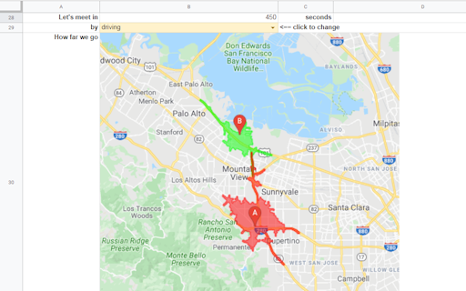
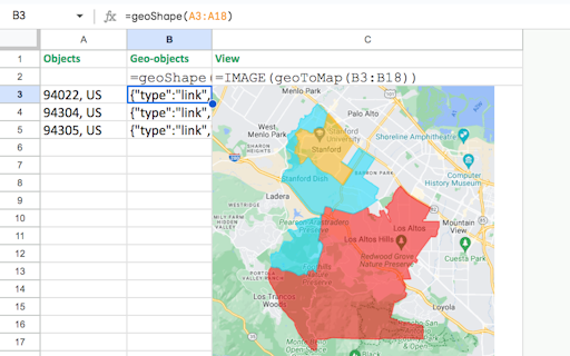
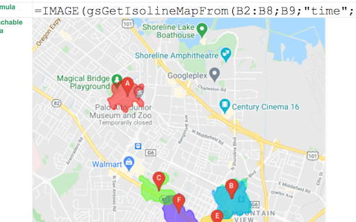
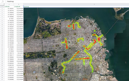
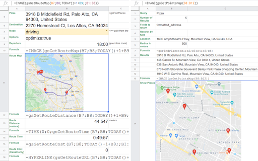
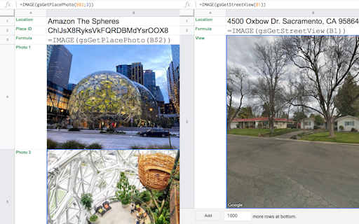
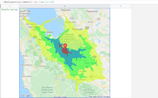
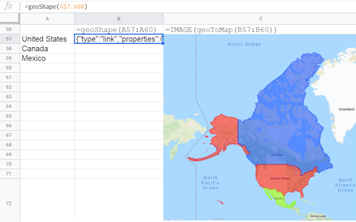
Bring mapping capabilities and geocoding to Microsoft Excel: insert heatmap, administrative boundaries, shapes, place photos and street views, download GeoJSON and KML, get address components, find places with details, build routes, show isolines.
This looks like a super handy tool for Excel! Haven't tried it yet, but I love how it integrates mapping and geocoding features. Definitely something I could use for my projects. Congrats on the launch!
1 year ago
Related Apps
-
 Manymap
Route planner for explorers with real-time collaboration
-
 AI Assist
A next-generation Clippy for a next-generation spreadsheet
-
 Retable
Airtable alternative - one tool to replace them all
-
 CapGo.AI
Fastest market research in Spreadsheet
-
 Coefficient for Excel
Sync live data into Excel from SaaS systems & DBs in seconds
-
 DataMonkey
Your GeoAI to combine in-house with public map-based data
-
 Gowalla
Keep up with your friends in the real world
-
 Tailbox
Mix of PokemonGo and Tiktok for travel
-
 Cohesive AI
AI powered web scraping & research in Google Sheets
-
 GRID 2.0
Next-gen spreadsheet with presentation layer & AI assistant